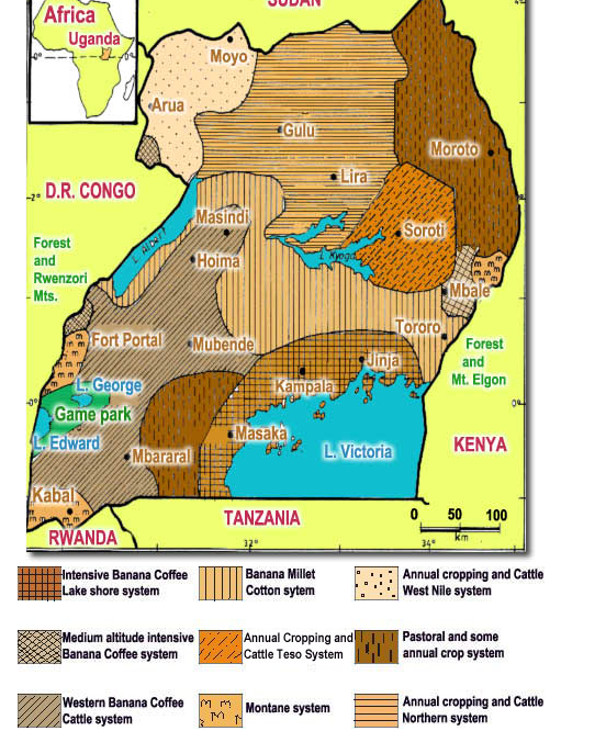
Physical Region Map: This is a map of the Farming Systems in Uganda. Uganda is a region linked together by their agricultural systems. Their economy is almost completely dependent on their agricultural system. Gulu is a city centered on reform and extremely important to rebuilding the country. Here we can see that they are one of the largest agricultural centers in Uganda making them a central key to the Ugandan economy. Kampala is the capital of Uganda and therefore also an important economic center. Coffee is one of their largest economic foundations. This map shows that Kampala is the center for coffee production.
Uganda. (n.d.). Retrieved September 19, 2015, from http://www.fao.org/ag/agp/agpc/doc/counprof/uganda.htm#2. SOILS AND TOPOGRAPHY
Uganda. (n.d.). Retrieved September 19, 2015, from http://www.fao.org/ag/agp/agpc/doc/counprof/uganda.htm#2. SOILS AND TOPOGRAPHY
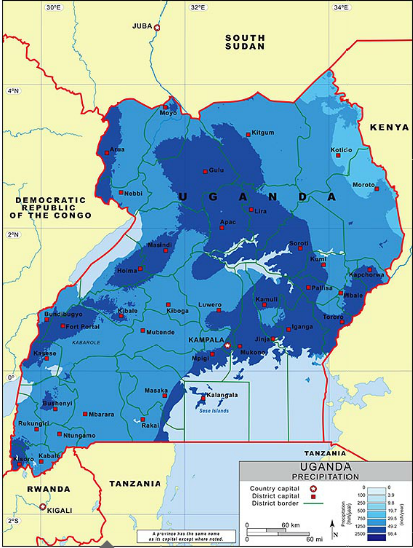
Physical Region Map: This map shows the rainfall in Uganda. Here we see that the two main agricultural centers in Uganda, Gulu and Kampala, fall under the category that receives the most rainfall. This explains the flourishing agricultural systems in these cities.
Precipitation Map of Uganda. (n.d.). Retrieved September 19, 2015, from http://www.bestcountryreports.com/Precipitation_Map_Uganda.php
Precipitation Map of Uganda. (n.d.). Retrieved September 19, 2015, from http://www.bestcountryreports.com/Precipitation_Map_Uganda.php
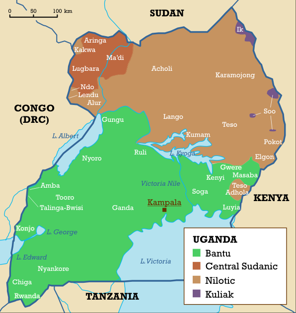
Cultural Region Map: This is a map of the languages in Uganda. The two main languages in the country are Bantu and Nilotic. Bantu is spoken in the capitol, Kampala. This shows how the country is divided into the north and south not only by tribes but by language as well.
(n.d.). Retrieved September 19, 2015, from https://upload.wikimedia.org/wikipedia/commons/5/57/Languages_of_Uganda.png
(n.d.). Retrieved September 19, 2015, from https://upload.wikimedia.org/wikipedia/commons/5/57/Languages_of_Uganda.png
